You know, a picture of the azure-blue waters of one of the falls on the Havasupai Reservation in Grand Canyon that's in many a calendar or desktop wallpaper? Well, I TOOK THAT PICTURE just a few days ago.
I had an opportunity to join 12 other intrepid, awesome, fun and funny women on a five-day Arizona Women of Adventure group trip to the Havasupai Reservation in Grand Canyon. The logistics in planning the trip were pretty mind-boggling, with two of the women leading the organization of gear and food. Sounds simple, two four-letter words: "gear" and "food." Not quite so, when you're talking hiking in Grand Canyon. I'll get to those details in a bit, but first an overview:
While many people refer to these falls as "Havasu Falls," the entire suite of these blue-green waterfalls is actually part of Cataract Creek, which flows northward from the top of the Coconino Plateau in northern Arizona into eventually the Colorado River, through Grand Canyon. Some folks call this particular blue-green stretch of Cataract Creek "Havasu Creek" and its surrounding area Havasu Canyon, even though it's part of the larger Cataract Canyon region. It took me awhile to figure this all out, and many terms are bandied about that could be confusing. So here is my attempt to boil down the Hav from the Su from the Pai:
Havasu: The name of the canyon and creek where the Havasupai live, part of the larger Cataract Canyon system. Also the name of one of the main falls that attract tourists like me. I'm going to refer to this entire place as Havasu from here on out, but it's really a part of the larger Cataract Canyon ecosystem.
Havasupai: The people of Havasu; means "people of the blue-green waters." Also the reservation and land they call home.
Supai: The village that most of the Havasupai people inhabit, at the near-bottom of Havasu (or Cataract) Creek.
The other falls besides Havasu Falls that people visit include Mooney, New Navajo (Old Navajo flooded out several years ago), and Beaver. Sprinkled in between these main falls are lots of smaller rocky and/or travertine terraces and pools.
The whole kit and caboodle is on the Havasupai Indian Reservation (the light green on the map below). There is a complex web of tribal connections between the Havasupai and other tribes (i.e. neighboring Hualapai) in the region (see Wiki Page), but for the most part, the Havasupai people have lived in Havasu Canyon at least 800 years (some sources state over 1,000).
Maybe they selected that area because after the scrabble down Grand Canyon, they simply decided not to climb back out (something that occurs to everyone who descends it and dreads the knowledge that they have to ascend back up at some point); maybe the unique blue-green water and surrounding area gave them the resources to thrive; or maybe the place was so secluded, difficult to reach, and therefore easy to defend against warring tribes (Yavapai and Southern Paiute to name two). In any case, they picked a nice spot to live and at one point claimed an area about the size of Delaware. After removal of most of their ancestral land by the expanding United States in the 1800's and especially after silver was found in Cataract Canyon (which basically left them with 518 acres), they fought back and won additional acreage in the 1970's, and their reservation now totals about 188,000 acres. Good for them.
About 700 Havasupai people now live in and around their main village of Supai. In Greg Witt's Exploring Havasupai, he reports that the Havasupai language, one of the unique Native American languages still in existence today, was an oral-only language practiced for millenia until it was finally translated into the written word just in the 1970's. In addition, he reports that it is the singular Native American language that is still spoken by all members of that tribe (some languages are only spoken by elders or tribal leaders, or have been lost to younger more U.S.-assimilated people, etc.). Another interesting factoid is that Supai is the only remaining community in the United States that still receives and sends mail via mule train.
Does that help? So when people say they went to "Havasu," let them off the hook. They did, but they also saw so much more.
What makes these falls--and their unique color--anyway? Well, lots of minerals for one, but primarily lime that exudes from springs. Springs feed into this portion of Havasu (Cataract!) Creek that have a high level of lime and calcium. These minerals settle out over time, building up on rocks and forming terraces often called travertine formations. Some of the falls here are born from these travertine formations; other falls are created by your basic rock cliffs.
Tourism is the main form of income for the Havasupai. There are several forms of recreation that one can undertake on the Havasupai Reservation, including river raft trips on the Colorado River, but the main attraction are the series of falls, pools, and trails that invite campers, hikers, and swimmers. The Havasupai have turned accessing this area into quite the art form--one can hike an 8-mile trail down Grand Canyon to the village of Supai, and then veer off 3 more miles to a campground equipped with picnic tables and compost toilets, or stay at Havasupai Lodge in Supai itself. Instead of hiking, one can also ride down (and back) on horseback or fly down (and back) via helicopter. For those that want to hike and camp, but may not find the idea of backpacking a bunch of gear back UP the canyon, there are horses available to haul your gear, food, and other supplies, while you conveniently waltz down the trail with water, snacks, and a camera. That's what we did.
 |
| Horses and mules have the right-of-way, watch out! Check out the video below to see how these horses move--- |
Each horse can carry up to 130 pounds. For the 13 of us, we reserved three horses. One was solely for the cooking gear and food. Two were for us. Do the math, and you see that we each can carry only 20 pounds--that's for everything; our individual tents, sleeping bags, sleeping pads, camp chair, personal items and sundries, and for me, my critical supply of knitting and crochet projects. It adds up quickly, and you find yourself tossing out more things from your tiny little duffle bag than what goes in.
All our stuff that's in our smaller duffle bags has to then be shoved into larger Army-style duffle bags. Each horse carries four large duffle bags. So the 13 of us had 8 large duffle bags to split between us. The bags then must be weighed, and the weights and name of our party leader has to be written on duct tape, which is tacked to the side of each bag.
What a fiesta it is to stuff and weigh our bags! Most of us drove from the White Mountains (two of us, Petra and Amy, came from Yuma) the day before our hike down and we all met at Hualapai Lodge in Peach Springs. A new and nice hotel, Hualapai Lodge was comfortable and clean. After noshing on snacks and wine, we trooped out to the parking lot to figure out the duffle bag situation. Probably an hour-and-a-half later, we proudly had 8 duffle bags ready to go, with our Yuma contingent also preparing the four food containers for that 3rd horse.
The first morning of the trip dawned early--we took our last real shower for the next 4 days, crammed into two cars full of duffle bags, and drove the 60 miles to the Hualapai Hilltop trailhead, where the Havasupai folks planted their horse corral, a large parking lot, and a bathroom. Since the campground at the bottom of the canyon is first-come/first-serve, our intrepid two-person Yuma contingent had left the hotel even earlier than us, dropped off their food bags at the corral, and started down the trail at first light to snag the best campsite available for our larger party. None of us had even met Petra and Amy before (!), but since the moment Petra offered to organize the food and leave in the dark to get us the best campsite, we knew we'd love them immediately. We did. Like the angels, Petra and Amy were. Food and a great campsite magically appeared. We truly appreciated it, too--we know how much thought went into preparing the quantities and menu for 13 people for four days. Wow.
 |
| 8 of our duffles ready to be packed onto horses |
We dropped off our duffles and headed down the trail. The first 1.5 miles is the steepest, traversing in switchbacks down about 1,500 feet in elevation loss. Walking poles helped the knees contend with the jumble of rocks and dusty sand. After that first leg, the trail evened out and became a slow descent along a gravelly, sandy stream bed. It was actually very nice, but no one can get away with the niggling thought that with every step down, there is the inevitable step back up when you hike out. So your mind took in the knowledge that shuffling UP a gravelly, sandy bed about 9-10 miles, no matter how slight the incline, will be slightly different than the skip down.
 |
| Here we go! Missing Petra and Amy, who started out earlier than we did |
 |
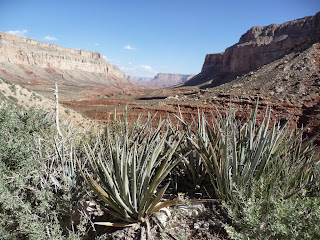
| View from below the first steep descent, looking towards Havasu/Cataract canyon |
 |
| A part of the hike |
 |
| A cottonwood! Must be getting close to water!!! |
We reached the village of Supai in the early afternoon, had a snack, looked around, and watched their helicopter lift off and return time and time again, hauling people and things up and back. While a 'copter ride would be pretty cool, we were all glad we chose the more challenging hiking route, as it was a lovely trek. We noticed the two rock sentinels above the village, that are culturally significant as they are guardians of the Havasupai people.
 |
| Sentinels guarding the village of Supai |
 |
| One of the many flights this helicopter took that day |
When darkness fell (and it gets really dark, let me tell you), Sara pulled out a blacklight to look for scorpions creeping along the canyon wall (why do we do this to ourselves?); they light up like nobody's business under a blacklight, with a number of them curiously close to Petra's and Amy's tents, who were obviously not in the car when Sara was describing how scorpions really take to canyon walls at night time. Thus, Julie and I mindfully put our tent about as far away from the canyon wall as we could.
 |
| Stolen from Google images, but this is pretty much what we saw, numerous times. |

We started the morning with a wonderful Yoga routine that stretched us out and helped us greet the sun, led by one of the two Julies in the group. Julie, my neighbor and dear friend, who loves my dog almost more than she loves me (and that's OK!), is my yoga mentor--she always picks the perfect routine to do for the situation before us. Stretching out our "downhill" muscles after the first day's hike, we were off to Mooney Falls.
We get to the overlook, it's amazing, lovely, and all that you think one of these falls would be. If this were in a National Park (which it certainly could be) and managed by our federal government, there would probably be an iron wall holding people back from the edge. Here in HavasuLand? No bars preventing idiots from falling over, just a hand-painted sign:
 |
| Mooney Falls from the top |
But to get to the bottom was confusing. We saw no trail, just a cliff face. Oh...there goes Sara (this is her 7th Havasu trip) through a hole in the rock. OK, this'll be fun. Through the hole, down a chute of slippery rock with rebar handles and chains to help you belay yourself down. Then a tiny little rock ledge to stand on as you peer around to the next challenge--a set of three ladders going straight down the face of the cliff. What the ?????? Really? Yup.
Climbing down, precariously and cautiously:
The bottom of Mooney Falls:
After a short stop, we continued on the 3-mile trail that went to Beaver Falls. It took us at least 2 hours. I was spent. A couple of creek crossings, wet shoes and feet, rocky trails, steep ups and downs, and then the last part, another Mooney-esque blind descent that tried all of our leg, arm, and core muscles just to hang on. But we did it, landing at Beaver Falls for an hour or two of swimming and lazing about.
 |
| I don't have alot of pics of this descent, I was a bit concerned for my life. |
Back up, pulling ourselves up these ropes and steps, in some cases limping along the trail as we returned, tired but happy, to camp. What a lovely, memorable day!!! All of us practically begged Julie to be sure and take us through a few yoga stretches the next morning, we knew we'd need something to uncramp the uphill, downhill, and climbing (= all of them) muscles in our bodies.
Our second full day was a day of rest. Perfect schedule, thanks to Sara. There's no way we'd want to hike back out that day, so having an extra day to pick a falls, lounge around, wash body and hair, take a nap in a hammock (some people take knitting, others take hammocks...), and just let our bones and muscles rest, was exactly what we wanted. I finished crocheting a hat I was working on for Sara.
 |
| "New" Navajo Falls |
 The next morning, it was time to pack up and head on out (or, up). The 5 a.m. call sounded, we stumbled around in the dark packing up those 12 duffle bags and trying to squeeze in coffee and eat a muffin-and-Ibuprofen breakfast. The bags were dropped off at the horse corral and we were off by 6:45. Over the next several hours, we walked and walked, and walked some more.
 And, we did it. All of us. Made it to the top! Holy smokes, it was windy at the top, too. As much as we wanted to just sag into our cars and take off, we had to manage those dang duffle bags. Take things out, move things around, make sure Yuma people got their Yuma stuff, and pack up the external luggage rack, etc etc while we were eating dust and sand from the wind. Finally, we drove off, hitting Seligman on Old Route 66 around 3:30 to have a late lunch/early dinner, and for many of us, a cocktail, at the Roadkill Cafe. Yes, there is such a thing.
 |
| Burma-Shave signs still exist along Route 66!!! |
Dark came quickly along I-40, as we drove past Flagstaff, Winslow, and Holbrook, finally making it to Show Low, where there was this melee of people scrambling to get all their stuff, hugs abounded, goodbyes were said, and promises to get together again soon were made.
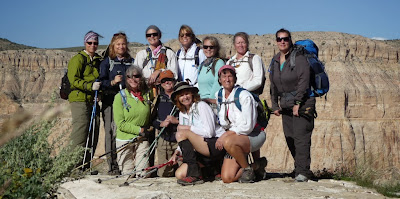
Yoga Julie asked each of us in her car what our three favorite things about the trip were. It's really telling that the first thing on nearly everyone's mind was the company, the friendship, the camaraderie--NOT the fact we were in this fantastic, scenic, surreal landscape that escapes words. That comes along eventually, as Havasu is on nearly all of our "bucket lists," and yes, we were awed by the grandeur and beauty--but it was the people we were with, the experiences we shared, and the bonds that we formed that really made the trip worth the price of a few sore muscles, some cut-up shins, and a couple of banged-up toes. To the People of the Blue-Green Waters, we thank you for sharing your home and environment with us; it was the perfect surrounding for what was ultimately a gathering of spirits and souls that will never be forgotten. Thank you, too, the Adventurous Women of Arizona: Amy, Ann, Cher, Deb, Janet, Janet, Julie, Julie (yes...two of each), Petra, Sara, Teri, and Theresa, here's to you and to making this trip the best it could be!!!
 |
| The trip begins: What the H*** are we doing, who are these people?? |
 |
| The trip begins #2: Group shot "pre-hike" in Show Low. OK, we're happy but no hugs yet--- |
 |
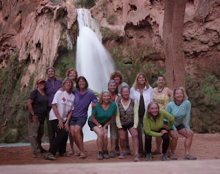
| The last night together: Hugs and laughter abound |
 |
| We are AMAZING!!!!! |


Thank you for sharing a truely wonderful story. As a husband of an AWOA, the description of your adventure really enlightened me as to how enriching these events are in my wifes's life. The bumps, bruises and sore feet will soon fade from memory but the feeling of accomplishment and friendship will last.
ReplyDeleteThank you, Jim. That comment means so much to me---I so appreciate you taking the time to let me know.
DeleteSue, what a fun read your blog is. You are a gifted writer. Looking forward to future articles. Dianna
ReplyDelete