Petrified Forest National Park continues to fascinate. A weather prediction of an unseasonably warm 55-degree day plus calm winds (what is a calm wind, really? But I digress) enticed us back to explore a part of the Park suggested by our previous hike leader, Gary. Gary gave us general instructions to park just south of this one pull-out here, look for a derelict old two-track road there, follow it to nearby hills, and find an old trail that switches from being visible to nonexistent a few times. And, he added, when in doubt, just wander back in the general direction of your vehicle. No problem.
We would be exploring an area known as the Blue Forest. The popular Blue Mesa loop drive and its associated paved trail would be visible at one point along our walk, as it hugs the east side of Blue Forest. However, we'd be exploring the interior area coming from the west, touching upon that paved trail for a short distance, then veering off again to wander further.
We found our pullout and the derelict two-track road, with Blue Forest in the distance. A sign indicated we were at the right pullout, as it aptly described the importance of the area we were entering.
A closer look at part of our hiking destination.
Since I can't do better than that interpretive sign, I'll repeat it verbatim:
"In the summer of 1921, heiress and explorer Annie Montague Alexander and her research partner Louise Kellogg set off into the badlands in front of you. Intrigued by fossils discovered by John Muir fifteen years earlier, Annie and Louise unearthed numerous specimens including phytosaurs and metoposaurs. The work of these women pioneered the science of vertebrate paleontology in Petrified Forest National Park. They were assisted by Dr. Charles Camp from the University of California's Museum of Paleontology, a museum that was founded by Alexander in 1921. Camp went on to work in the area for nearly a decade."
Annie Alexander, ca 1921. Cool lady, no?
The sign continues: "Since that time, research teams from organizations such as the American Museum of Natural History and the Smithsonian Institute have worked in the Blue Forest collecting fossil vertebrates. Annie Alexander's legacy lives on through the work of scientists who continue to make discoveries here about life in the Late Triassic." Wow. A couple female paleontologists in the early 1920's exploring this part of Arizona? Hats off; color me impressed!
The interpretive sign shows an image of Annie's camp in the Blue Forest:
And examples of skulls (a reptile and an amphibian) unearthed in this area:
Almost verbatim from the sign at the Tepees pullout, across the road: The Blue Forest and the Tepees are examples of the Blue Mesa Member of the Chinle Formation of sedimentary rock found in the Park. Sediments of the Blue Mesa Member were deposited by a vast, tropical river system that flowed through this area during the Late Triassic (225 million years ago), similar to what the Amazon River basin looks like today. How do experts know this? Rock color, rock type, stacking patterns, and the fossils they contain give clues to geologists and tell a prolific story about the past environments and how they shifted and changed through time.
The Tepees, examples of rock layers
Brown and yellow sandstone layers were deposited in the river channel, showing where the river flowed through time. Blue and red mudstone layers were laid down in the floodplain. Whitish layers were ash from volcanic eruptions, and are used to determine the exact ages of the rock. Fossilized plants and trees, like horsetails and ferns, indicate a tropical environment. The Tepees, and the adjacent Blue Forest, while located in the middle of the park, expose one of the lowest, and therefore the oldest, rock members within the park.
We were in for an interesting hike. Now onto the photos!
Following the derelict road at the beginning of the hike.
We've only just begun. Looking back and seeing our truck,
that tiny dark squarish thing in the upper right quadrant.
You'll see a lot of husband-as-reference-point shots; see him??
Examining a log and imagining the "forest that was."
A few hoodoo-ish looking things
in the "white ash" volcanic sediment.
Petrified log with splintered shards cascading down the hill.
Perhaps the swirl of volcanic ash, or the force of an ancient sea?
The trail is still visible.
Entering a maze of colors.
Not much wiggle room there. Pay attention!
This trail, um....where is it taking us???
Down into the hills, of course. Hang on!
On a short portion of the Blue Mesa paved trail.
Veering off the pavement, circling around the larger hills.
We found ourselves in a floodplain of colored petrified wood fragments.
It was simply stunning.
A perfect cross-section of part of a petrified tree
Let's hope this dry wash is the way out...
Welcome back, now gimme some food!
That raven was just about the only living being we saw. Okay with us, though. Today, the creatures from the Late Triassic kept us company.
What's great about visiting any place with layers of history attached to it is the ability to imagine what may have transpired long before--sometimes centuries before--you arrived at that very spot. Go to our nation's Capitol. Imagine the purposeful strides up the stone steps by our forefathers or the arguments and discussions they had that shaped our democracy. History is cool like that. It allows one to wonder and imagine vividly what might have gone on before. I've been to many historical sites, put myself in different eras, and created scenes in my mind as a way to grasp a sense of that particular past, and therefore, a sense of that particular place.
However, it's a rare place that can make a person feel like the past is reaching out to touch you instead--with an invisible force that you feel into your bones. Where a silent but thrumming vibration calls out to every cell in your body, soul, and mind repeating "you are here now, but once, so were we."
Southeastern Arizona is that place for me. The sky is huge; the clouds low enough that I find myself unconsciously lifting a hand to touch them every so often. The horizon is far off, but never without some jagged mountain range interrupting the flat land in between. The history here is long and complex, but rotates on the axis of the Apache people. No doubt it did not begin with the Apache, but they were the penultimate masters of this place. It's like the geological forces of a few billion years made this land just to fit the Apache people.
Now, I'm not particularly drawn to Native American cultures. I enjoy learning about them, and will read every interpretive sign at any given roadside stop or museum, but I'm not so avidly curious or even admirably fascinated as to venture much deeper. What I do jive on, though, is the feel of a place. It's the Taurus in me--the bull whose feet are planted in Terra Firma.
So, when I do venture to southeastern Arizona, I am definitely planted in its sense of place. However, it is one of the rare landscapes where I can't help but feel drawn to, and fascinated by, the associated culture and history of the native Americans who called this place home. Each time I go, I begin feeling a thrumming in my core. If I come from Tucson, it's when Interstate 10 rolls through the massive boulders of Texas Canyon (where a hundred miles of billboards in either direction invite travelers to see "The Thing!!"). Or this last time driving from home via Safford, it hit me west of Willcox (surrounding billboards: "home of famous son, Rex Allen!!"), seeing the expanse of white, alkaline, and seemingly empty hardpan that is the Willcox Playa. These invisible vibes get stronger as I leave the interstate behind and see the ragged, yet billowy, rocks of the Dragoon Mountains--the epicenter of the Chiricahua Apache home, and last resting grounds (exact location within these boulder piles unknown) of its revered leader, Cochise.
The Apache were scattered across much of eastern Arizona, western New Mexico, and northern Mexico, forming multiple tribal units based on geographical and cultural separations; Mescalero, Tonto, White Mountain, San Carlos, and Chiricahua, to name a handful (to say nothing of the bands within these larger groups). It is here in southeastern Arizona where Cochise, leading the Chiricahua Apache in the latter half of the 1800s, gave the U.S. military a run for their money--one of the last native American peoples to do so. Skirmishes and outright warfare were held throughout this region, with Cochise at one point lying low deep within the Dragoons for two solid years, craftily resisting military scouts as they actively sought to capture, imprison, and put down the Chiricahua Apache once and for all. The craggiest, rockiest, ruggedest canyon within the Dragoons is known as Cochise Stronghold. Now managed by the U.S. Forest Service's Coronado National Forest, a campground and 5-mile trail invites visitors to explore this magical place, where rocks the size of buildings pile precariously upon each other. One visit and it's easy to not be surprised that a group of people, actively pursued by the U.S. military mind you, could remain hidden and untouched for two years.
Meet the Dragoons
A couple weekends ago, my husband Bruce and I configured a weekend jaunt to the greater Willcox area, situated in the Sulphur Springs Valley. The Dragoon Mountains hug the west side; the desolate flat of the Willcox Playa, stretching for miles, marks the center; the Dos Cabezas Mountains flank the eastern edge, their "two heads" a prominent landmark; and the Chiricahua Mountains, the largest range in the vicinity, cap the southern boundary. The community of Willcox, a large power-generating station (called, not surprisingly, Apache Station), agricultural fields--either fallow or active--with scattered ranch homes, and now about 15 wineries that have cropped up in the past decade are the signs of the present-day people trying to make a living in this often-overlooked spot. All of this is within Cochise County where we were on our way to our home for the next two days--Cochise Stronghold Retreat B&B.
Cochise, Chiricahua, Apache....are you sensing a theme?
Why this place and why right now--in the middle of winter? Well, the wineries for one. Need I say more? A second major draw is the thousands upon thousands of wintering sandhill cranes that lay claim daily to the fallow (and at times actively-growing) agricultural fields. Between the cranes and the dozens of wintering raptors (a red-tailed hawk seems to be silhouetted on every third telephone pole, while northern harriers and ferruginous hawks prowl the fields for rodents), the Sulphur Springs Valley is a birdwatching mecca in the winter months, and hosts an annual birding festival (Wings Over Willcox) every January.
Cochise --- check!
Cranes --- check!
Cabernet --- double check!
A final draw for both Bruce and I was Fort Bowie National Historic Site. Nestled within a high mountain saddle between the Dos Cabezas and the Chiricahua mountain ranges lie the adobe-walled remains of Fort Bowie (locals stressed that it's pronounced like the marine term "buoy"). Established as a protective military outpost for early settlers as they swept through and tried to settle Apache lands, Fort Bowie served, and claimed, the lives of many settlers, Apache people, and U.S. troops alike. Neither Bruce, with his love of the history of the West, nor I, had ever visited Fort Bowie in our decades of living in Arizona.
Between our comings and goings, we were able to visit a friend who owns and operates--with help from his entire family--the well-known Apple Annie's Orchard (you-pick fruits and vegetables), meet up with other friends from nearby Sierra Vista for our Fort Bowie visit, and stop at the Bonita Bean Company to pick up some ten-pound bags of mixed dried beans. Yum. Future soup!
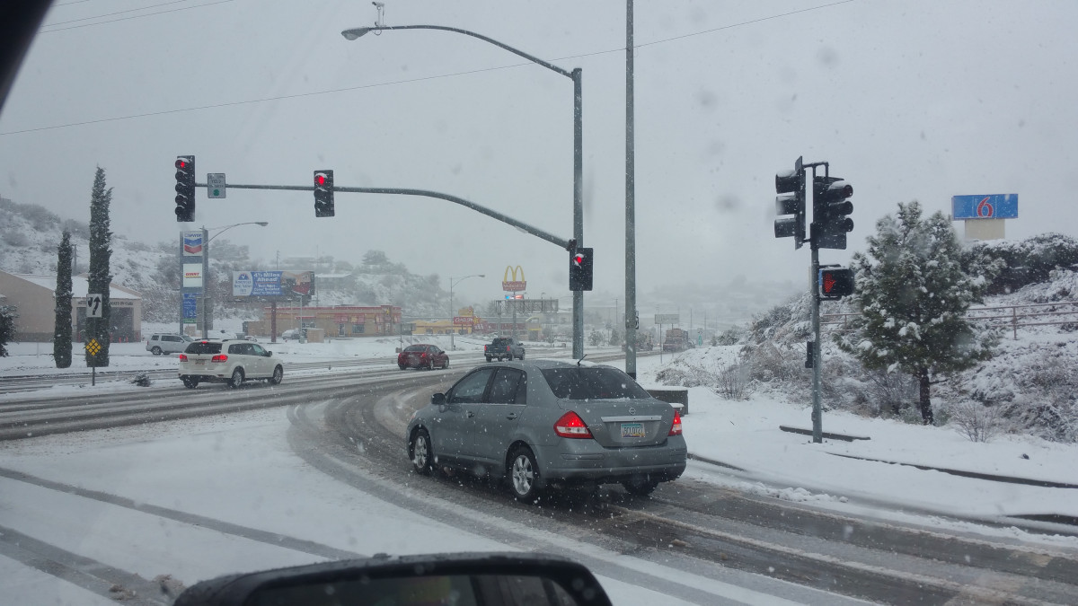
It was a packed weekend, and made just a tad more interesting as we drove out of the White Mountains smack dab into an enormous winter storm that left snow in low elevation places that rarely see the white stuff and cold temperatures in its wake.
Really, winter? You had to pick this weekend?
I have to say, though, the snow and its concomitant gray skies and fast-moving clouds shrouded the entire region with a color palette that was almost magical in its scope of muted grays and whites among the tan, dried grass, orange sherbet clouds at sunrise, and occasional patches of blue sky.
Coronado Vineyards was our first stop, just off the interstate east of Willcox. The oldest active vineyard in the Sulphur Springs Valley (2006...), their tapas menu was impressive and the wine tasting was a perfect hit after a near 5-hour drive through lousy weather. We had made it through wintery weather into the valley, and our weekend had begun!
Vineyards awaiting summer sun
My excitement grew as we approached the Dragoons and began looking for our B&B. The closer one gets to the Dragoons, the lower the jaw drops. It's a stunning place, but again, it's made even more so by the sense that not much of the land itself has changed since the days of Cochise. The wind blowing through the rock crevasses could easily be the spirits of Cochise and his band. These rocks--they have seen much. Their stories are still there, and will remain there, for millennia.
Closer and closer into the Stronghold we drove, looking for our B&B and being surrounded by darkening gray skies, massive rocks, and a quiet that was almost deafening. We drove up the signed driveway to a cluster of adobe dwellings. A chalkboard written with with our names hung next to a casita door and beckoned us to enter. We walked into a warm, inviting living room with a fire crackling in the wood stove. Bird feeders placed outside our patio door attracted everything from songbirds, jays, and woodpeckers to deer and the B&B's chickens.
Our casita at the edge of Cochise Stronghold
Our weekend had begun. The next morning, the sun barely creeping over the horizon, we grabbed our cameras and binoculars to catch the early morning flight of sandhill cranes. They leave their nightly roosting spots on the Playa, and fly in flocks to feed in agricultural fields throughout the valley. Their gangly, yet graceful, silhouettes coupled with their almost prehistoric cackling calls made us feel positively happy to be alive.
Unexpected beauty of a power station...
Returning for breakfast (a beyond-delectable cuisine cooked and served at our casita by a youthful Cassie--who grew up in Willcox, moved to the big city, decided the big city rather sucked, and was drawn back to Willcox to make a go of it), we cleaned up and prepared for a day of hitting wineries, then meeting up with our Apple Annie's friends (John and Anne [or "Annie"] Holcomb).
The wineries were pretty darn impressive. Most were start-ups by those intrigued by the soils and climate of southern Arizona--business folks that were either already knowledgeable about wine, or entrepreneurs that did their research and decided to take a chance--and now have families ensconced in the Sulphur Springs valley. Bruce, the designated driver, found himself wishing he had a dolly to help lug numerous bottles of wine out to the truck that I, the designated drinker, determined needed a home in my wine rack.
An old bank transformed!
Marty Robbins AND Rex Allen??? Whoa!!
The haul
The Holcomb's (Apple Annie's) orchard operation was astounding, despite being there in winter with nothing growing. Getting a tour of their hundreds of acres of orchards and gardens, hearing how they manage everything from food production to designing events to draw people (including a 20-acre corn maze with six miles of twisty pathways and only three ways out), and seeing how their entire family--grown kids and spouses and grandkids--all pitch in, was inspiring. Turns out our B&B's Cassie grew up in the house that is now owned by the Holcomb's son, who manages 160 acres of the vegetable side of the operation. They are one of the Willcox region's major employers (many a Willcox high schooler learned the value and responsibility of a job from working summers at Annie's), and serve a vital role in this struggling economy. Hats off to this dedicated family (and, to you Arizona readers, go pick some fruit or pumpkins this fall!!!).
Aerial view of 20-acre corn maze at Apple Annie's --
The photo can't capture how huge this really is
Dinner with the Holcombs, then back to our casita, where the wood stove was again merrily crackling away, we relaxed and soon conked out.
The next morning, it was time to meet my former coworker and good friend Brooke and and her partner Al in our quest to see Fort Bowie for the first time.
The National Park Service doesn't make it easy to see the historic fort site--which is great, in my opinion. While there is an ADA-access road to a visitor center on the far eastern side of the saddle, most people must make the journey to a parking area up a winding dirt road coming from the west. From there, grab your water and camera, because you're going on a hike. A 1.5-mile trail, peppered with interpretive signs at key points along the way, takes you to a cemetery (words can't describe this site where more than 100 people are interred and the prevailing sound is wind rustling the overgrown grass), old stagecoach trails, remnants of a Butterfield stagecoach stop, and Apache Spring. Ah...that's why this fort is located in the middle of freaking nowhere. Water.
Apache Spring; it doesn't look like much,
but without it, here'd be nothin'
Then, over the last rise...the fort. Any wooden structure is gone, the wood and roofing timbers removed long ago by adjacent landowners after the fort was disbanded. Rock foundation and adobe-walled ruins are pretty much all that remains. Interpretive signs are tastefully placed, using historic photographs from the very vantage point where you're standing, and show what the fort looked like in its heyday.
Corresponding sign to above photo
Corresponding sign to above photo
The Fort, and above, what stands now
Perhaps my favorite sign ever
The Fort was active throughout the days of both
Cochise and Geronimo
After a long meander through the ruins, we hoofed it back to the truck, and headed to the small town of Bowie, where hey, what's that? Another vineyard! One last tasting at Fort Bowie Vineyards, a purchase of a bottle or four of wine and some local pistachios and pecans, and time to head home.
Cochise County. There is no doubt history is part of its present, because you can feel it. Seeing the fallow, scrub-filled agricultural fields, one wonders what the future holds, as water--once again--is the driving force that makes all things possible. Then, dig just a bit deeper and meet the people who have been drawn back, like Cassie--or who refuse to leave, like the Holcombs--or who come to start anew, like any of the winery owners. There is indeed a sense of future here. One can only hope that they, too, are okay with bringing the past along for the ride.