 |
| Overview of Canyon de Chelly; from map in visitor center |
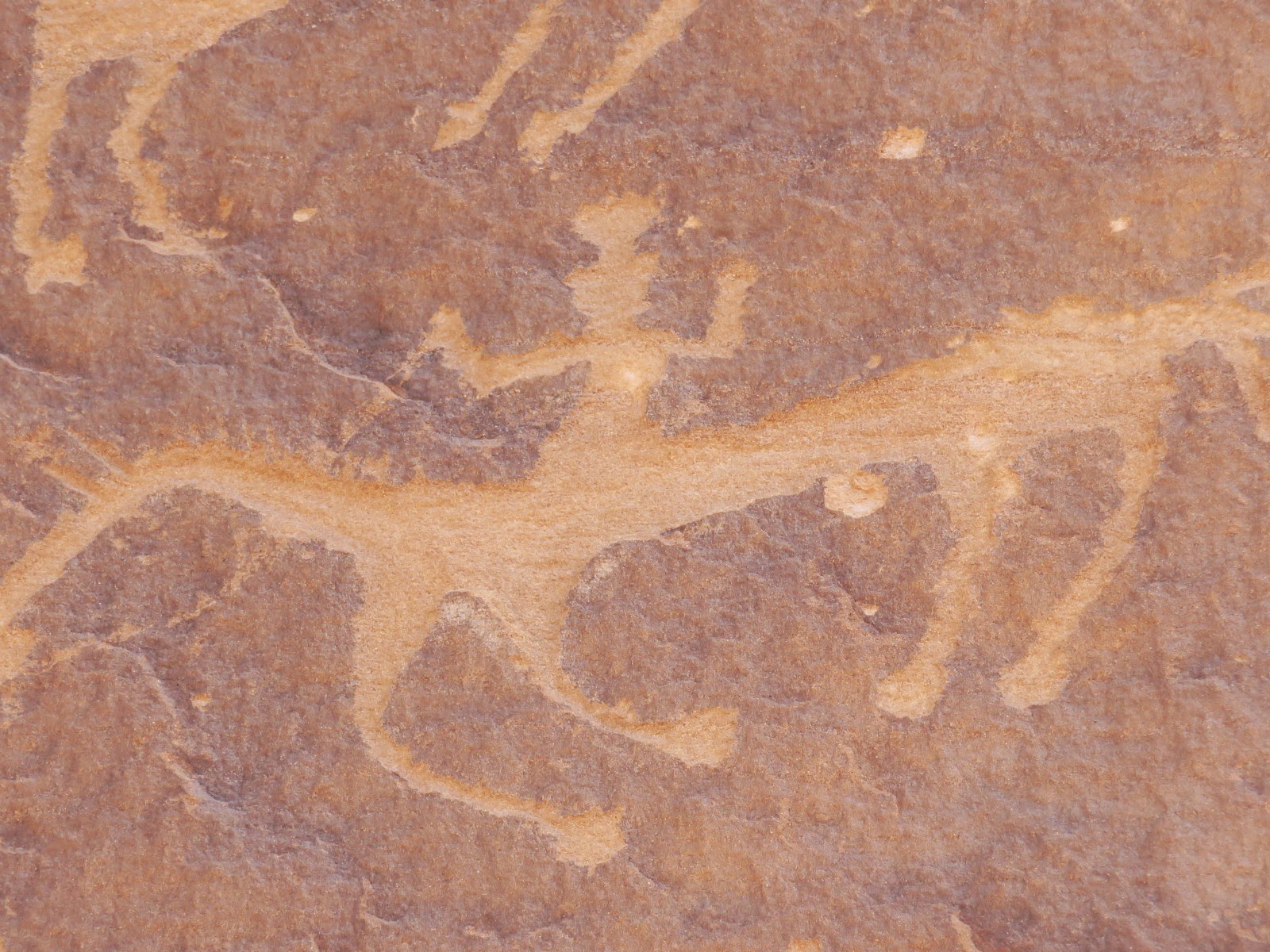
And they do. Stories and tales abound, many handed down verbally over time to family and clan. Some, however, are etched in rock as petroglyphs, others are painted on the vivid red and tan canyon walls with a mineral powder mix as pictographs--and these stories seem to be the most magical of all because in many cases, it's up to our imagination to determine their meaning.
Both cultures merge in Canyon de Chelly ("de shay"), just outside of Chinle. While fully on Navajo land and managed by the Navajo people (and National Park Service) as a national monument, Canyon de Chelly has both Hopi and Navajo history, as well as Anasazi, who inhabited this canyon long before these relative newcomers.
With friends Sharon and John, Bruce and I took a guided tour this past weekend. To travel along the bottom of the canyon, you must be accompanied by a certified guide. There are other options for visitors; one is to drive the two roads along the periphery of the canyon on the top; and a second option is to hike down to the famous White House Ruins (any calendar of the southwest will probably have a photo of White House Ruins) which gives some sense of the splendor that awaits when you're in the bottom of a red rock canyon looking up. We chose the guided tour, as that would offer more opportunities to see ruins, petroglyphs, and pictographs.
Our guide, Delbert George (he went by George), was eager to share his wealth of stories and information about the canyon. To become a guide, he had to undergo an interview process that tested his knowledge of the geology, cultural history, and current management of the park. He also had to answer such questions as "which family lives at the base of the big rock by the tree stump, and which family owns that peach orchard at the curve of the river by Two Owls rock?" The guy knows his stuff, for sure.
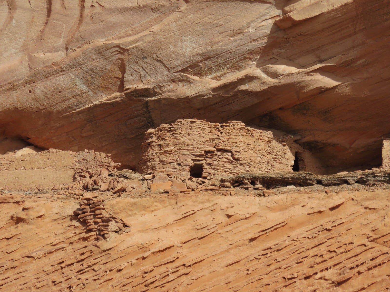
To make a centuries-long story short, the Anasazi, a prehistoric Pueblo people, lived--and flourished--throughout the Four Corners region in the American southwest from about A.D. 1 to 1300. Then, from reasons not totally understood even today, they essentially vanished across the land. Much of the rock art here, as in other areas, are from the Anasazi; but there is also early rock art from Navajo and Hopi peoples scattered throughout the canyon. Most, if not all, of the very cleverly-designed pueblo dwellings (adobe and wood) were constructed by the Anasazi, and found on ledges, nooks, and crannies that seem to be impossible to reach. You see later, as Delbert George would point out, small indentations signifying hand and footholds along the canyon walls to access these dwellings. How did they get the materials up there to begin with? How did they haul water and food up there while scrambling up a vertical wall using only fingers and toes? It's a marvel of human grit and the determination to be safe and survive.
Had it not been for both the rock art and the solid foundations of their structures, they would be unknown to us, as the next people to arrive and inhabit this canyon came 200 years after the Anasazi left. Archaeologists popped in and out, when allowed, to conduct formal inventories of the cultural resources in the canyon around the early 1900's, around 1965, and in the early 2000's. By the end of the 1965 survey, about 430 sites in total were documented. The latest survey in about 2004 found about 1,000 more sites. Even now, archaeologists estimate only 65% of the entire canyon has been surveyed. More treasures remain to be found.
 |
| Perhaps the most famous ruins in Canyon de Chelly: White House Ruins, named for the almost-gone white wash on the original walls |
Canyon de Chelly is just one area in the homeland of the Dine', which stretches between four mountain peaks in the Four Corners area, all considered sacred: Blanca Peak (Sisnajini) and Hesperus Peak (DibeNistaa) in Colorado; Mount Taylor (Tsodzil) in New Mexico; and the San Francisco Peaks (Dook'oosliid) in Arizona. To subdue the Navajo (who used Canyon de Chelly as a stronghold) when the Bilaga'ana arrived, a certain Colonel James Carleton led a campaign to remove the Navajo entirely away from their homeland to force them to "forget" their heritage. He engaged Kit Carson to lead this effort in 1863--which they called the "scorched earth campaign." Thousands surrendered and were gathered at Fort Defiance, and then forced to walk nearly 400 miles to Fort Sumner in eastern New Mexico.
 |
| Map of Four Corners area showing Navajo place names |
 |
| A little closer |
 |
| Even closer; see Chinle and east of that, "Tse' Yi'" or "Chelly" as we dumbed it down |
I was under the perception that the Navajos and Hopis aren't...well...the best of friends. This notion was dispelled by Delbert George, who said with a flourish "oh, that feud was so overblown," and proceeded to relate the story of two warring families a decade or two or three ago (the details escape me as I was already hypnotized by all the stories I was hearing), Navajo and Hopi, one whose daughter married the other one's son. They couldn't decide where to live--on Navajo land, or on Hopi. Court case followed, a lot of angst, bad feelings, people lining up on both sides, and absolutely no agreement; the judge decreed he would divorce the couple. Each had to return to their respective families, and the families had to stay away from each other permanently. Almost made the Hatfields and McCoys seem tame.
As we tour the canyon, we see families tending their crops and sheep grazing in pastures. Orchards of fruit trees pepper the creek flowing through the canyon. It is a well-lived and well-loved place.
 |
| Grazing in the shadow of pre-historic ruins, how cool is THAT? |
Riding up and down the canyon, visiting ruins and rock art sites, talking with craftsmen and women, listening to Delbert George relay story after story--it was a memorable day. However, I think it will be the moments of silence, when just the breeze and cottonwood trees talked to me as I pondered these ancient drawings and homes, that I felt the most connected to this place where red rock, blue sky, and green trees meet, and where the conversations of the ancient Anasazi may be heard if you listen closely enough.


